A few miles up the road from St. Augustine, the landscape changes from endless miles of sandy beaches to wilder salt marshes, estuaries, and individual barrier islands. No longer do beach cities and development extend to the waves lapping at the shore.
The Atlantic coast of Georgia (USA) is filled with inlets, outlets, and barrier islands. It is a magical place of winding estuaries and tall marsh grasses that glow in the sun lending the nickname, the Golden Isles. Due to bad weather and limited time to meander and explore, I had to make like a dragonfly and zip through this area, lightly touching down from time to time. Here are a few of the highlights.
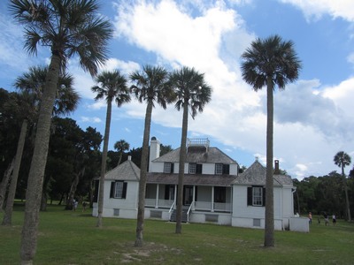
 St. George Island (can you see the English connection in that name?) is the site of the Kinglsey Plantation, a national historic site depicting life on a Southern plantation. Since the idea of Southern plantations has a negative connotation, due to the Civil War, I recommend visiting and learning more about this era of American history.
The part the history books don’t tell is that under Spanish rule, slavery was outlawed. (In fact, Ft. Mose, just north of St. Augustine, was a settlement of Africans – freemen and former slaves.) But, when the British and later the Americans took over, land owners were actively recruited but were not granted tracts of land to work agriculturally unless they had a certain number of slaves for every acre. Yeah, I know, shocking isn’t it?
Jekyll Island, once the winter playground of the rich and famous, this island is home to “cottages” built by people with names like JP Morgan, Vanderbilt, Goodyear, and Pulitzer that are bigger than the houses, even McMansions, of most people today. A group of these millionaires, bought the island from the family of the original plantation owner and created an exclusive club for the rich and famous. Many historic moments occurred here such as the first meeting of the Federal Reserve and the first transcontinental telephone call.
This slideshow requires JavaScript.
Today, anyone, for a small fee, can drive to the island, tour the historic district and get a sense of the opulence of the Victorian era. You can rent a cottage or a room in the turn of the 20th century inn, or if just a day tripper, wander through the public rooms viewing vintage photographs, grab a bite in the Bistro, or dine in luxury in the historic dining room. Rent a bicycle and pedal through the historic area; head to the beach and on your way you will discover ruins of the original plantation house, the old cemetery and enjoy scenic vistas and byways.
 Be sure to stop at the Georgia Sea Turtle Center where nestlings are monitored and injured sea turtles are rescued, rehabilitated, and if possible, released back into the wild. There is a nice interactive exhibit hall with live animals. Your admission fees support the work they do to preserve these magnificent creatures, some of whom are threatened and endangered.
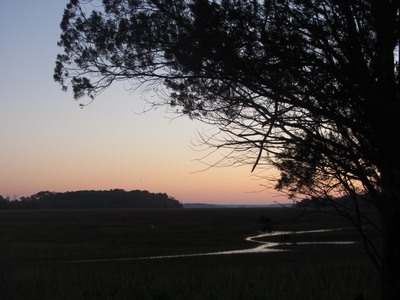
Skidaway Island is the home of a large state park that provides access to the salt marshes and estuaries. The campground is located on a large hammock on the intercoastal waterway, a brackish water river system that extends most of the way down the eastern seaboard, separating the mainland from the barrier islands, offshore, which serve to protect the land mass from storm surges.
These barrier islands afford opportunities to enjoy unspoiled beaches, paddle quiet backwaters and estuaries, hike, bird watch, and get away from it all in many ways. I could spend months or years exploring them all, but alas I do not have the time. I look forward to another opportunity to travel this way, stay longer and explore deeper.

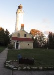
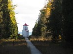
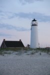
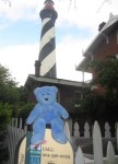
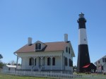
 When I visited the Tybee Island Light Station and Museum, near Savannah, Georgia, I learned the real and really quite obvious reason for those unique patterns — called a day mark, they are a way to identify which lighthouse is which when you see them by day.


 Don’t leave without lunch at the North Beach Bar and Grill between the lighthouse and the beach. The smells emanating from the kitchen make your mouth water and the coastal Americana decor is a delightful beach break.