Tall Ships

Before the days of steam engines, the world relied on manpower, wind, and water to get things done. Wooden ships with tall masts sailed the seas under yards of canvass sails. Journeys were long and dangerous; many perished in battles, pirate attacks, and storms that battered the ship and sent all hands into an unforgiving sea.

Though today, wood and rope have been replaced by steel, and sexton by GPS,  it is still felt that only by matching hands against the elements under sail does a seaman truly learn about the sea.

When in Portland, Maine recently, the “tall ships,” a collection of sailing vessels from around the world sailed into Portland harbor. Ships large and small, including a replica of a Spanish galleon, provided tours and sailing opportunities to throngs of visitors, while pirates roamed the streets, flags flapped in the breeze, and music filled the air.

This slideshow requires JavaScript.

Since the festival extended into Monday, I had the opportunity to board the USS barque Eagle, the Coast Guard sailing training ship. Gleaming in polished wood, and brass and strung with miles of cabling,  yards of canvass sails, and baggywinkle (see the link), it is a magnificent vessel of a former time, preserved for today.

All aboard Matey!

Photo Tour – Taxco, Mexico

I have left Taxco de Alarcon, Mexico behind. As I settle into my new home in the US, I remember often the sites and sounds that make this lovely city so unique.

I thought I’d share them with you here. Sit back and enjoy the tour.

This slideshow requires JavaScript.

Sit back and enjoy the show.


The Ruins – Tehuacalco

Not too far west of Ocotito is an archeological site, the ruins of an ancient indigenous people, known locally as “The Ruins.” Tehuacalco, or sacred place of water, was discovered only recently and opened in 2008.The site interprets a center of government and worship, which ruled over a vast area roughly covering all of Guerrero state, and cities to the north, to the Pacific coast, and all the way to Jalapa in the southeast on the Atlantic.

It has a modern interpretive museum and bi-lingual (Spanish and English) signage, though as part of a group of 38 Spanish speaking friends, ranging in age from 3 on up, I had little chance to read the signs.

Tehuacalco archeological site, MexicoSince the ruins were discovered buried pretty much intact, rather than torn apart and the stones scattered, it appears that this site was abandoned by the people (for some unknown reason) rather than discovered by the Spaniards. Its location, high on a remote mountain, and a lack of silver or gold, may have played a role in that outcome.

One of the four points (directional mountains, Tehuacalco archeological site, MexicoThe people who lived here, worshiped the god of rain and water (essencial to life) and chose this location because of the abundance of water. They built a high temple, which faced the four points (or directions), where on each season’s solstice, the sun came up directly over one of four neighboring mountains. (This indicates to me that they may have worshipped the sun as well, though they could have just been marking the seasons.)

The building that housed their gods is gone now; all that remains is the temple mount. Below the temple is the government mount with some remaining ruins, several stellas (stone markers) which marked the passing of time (days, hours, and seasons), and the ball court.

Similar to other ball courts in Mexico and the Americas, this game, which was played by just two people, consisted of the players batting around a 5 kilo (about 11 pound) ball, made from a local tree trunk, using only their legs or shoulders (sort of like soccer or football if you come from these parts.) The object was to get the ball into a small opening in the wall at center court.

The ball goes here, Tehuacalco archeological site, MexicoThough the game was likely played every day, once a year, the two best players were selected to play to the death, literally. All the citizens would come to watch the match, standing above the court in the grassy area, one side rooting for each player.

The winner of the match was sacrificed to the gods (yes, I said winner), while the loser was ejected  from the society to fend for himself amidst wild animals and poisonous snakes —  live or die, never to return.

On the day of sacrifice, a procession moved along the sacred pathway and up the stairs and steep incline to the temple mount. Each level of elevation marking one step (level) closer to the gods. Only the priests, kings, and sacrificial victims were allowed to climb the stairway to the gods. The average person stood in a field below the temple and watched the spectacle as braziers lit up the night sky and shadowy human forms performed rituals and dances culminating in the sacrifice of the victim and his beating heart being offered to the gods.

I learned a couple of interesting things visiting this ancient site:

Ancient glyph, Tehuacalco archeological site, Mexico 1) What I have always thought (and been told) was a decorative way of building rock walls using small stones between the larger rocks, turns out to have a practical reason (though lost to most Mexicans today.) The small stones allowed for more movement in the wall during seismic events (earthquakes) and thus the walls were less likely to come tumbling down.

2) The interpreter told us that the original pozole, a special soup traditionally eaten on Thursdays, Sundays, and holy days in this area, was made using the arms and legs of the sacrificial offering. Each bowl was topped with a small piece of the sacrificial victim’s meat, which was supposed to bring strength and protection for the coming year to those who ate it. As the guide said, some of our customs today, have their origins in these pagan peoples.

After a hot, sweltering, but very interesting afternoon we headed down the mountain to cool off in the river. But that is another story.

Hasta luego (until later),

If it is Monday, it’s off to the Mercado

In Mexico, you don’t just go to the supermarket and buy everything you need (well, you can sort of, if you like your fresh fruits and vegetables a week old and tasting like the rubber tires in the next aisle over.)

Most people shop the mercado (fresh market) where vendors sell everything from “fresh from their garden” fruits and vegetables, to meats, eggs, cheese, dairy products, herbs, dried fruits and nuts, masa (for making tortillas), housewares, hardware, clothing, and even handmade shoes. If you need it, someone will sell it.

In my house, the day to go to the mercado is Monday, that is because in addition to the main mercado downtown, there is a small mercado just around the corner. It is much easier to buy and transport heavy fruits and vegetables home from there than halfway across town. We load up on everything we think we will need for the week. On Mondays we eat like kings but sometimes by Sunday it is slim pickin’s.

Shopping done

Shopping done

Here is a tour of a Mexican mercado.

This slideshow requires JavaScript.

A Walk in the Country – El Ocotito, Mexico

When visiting El Ocotito recently, my hostess wanted to take me for a walk (ir de pie) to a place outside of town where there was a lake. It was hot but carrying water and my parasol (not to be confused with my paragua, which are one and the same unless it is raining) I was up for the walk. Dipping my toes in a lake sounded MAHvelous!!!

So we walked a few blocks to where the cement road ended and a dirt road began.

Not the end of the world but you can see it from here, Ocotito, MexcioWe walked through a tunnel under the autopista to Acapulco, which was filled with jumbled  rocks and ruts, and came out the other side to what looked like a double walking path.

tunnel entrance, El Ocotito, MexicoWhile inside the tunnel, which was treacherous on foot, a car came bouncing along, scraping bottom every so often. Then a little further down the path, a walker in a hurry to get somewhere passed us by. Then we were met by a man on horseback, people with wheelbarrows and machetes, people on bicycles, and people herding livestock. Apparently this was a major thoroughfare from one town to another!

Along the way we discovered a horse and foal in the field, a tamarind tree ripe for harvesting, people making adobe bricks which were drying in the sun, a young man harvesting sand from the river bottom, escaping  goats, a spooked colt, and more. Take a peek below.

This slideshow requires JavaScript.

After we had walked a good ways, we came to an area that had a little water covering the road. We sat under a tree, drank water and rested, letting the breeze refresh us. When we arose, it was determined that we needed to return to the house.

But what about the lake? Only after a long hot trek home did I find out that near the muddy spot on the road was where the lake used to be. It dried up and only the wet trickle that muddies the road and trickles into the neighboring field remains.

As with many things Mexican, things are not always as they at first seem.


El Ocotito

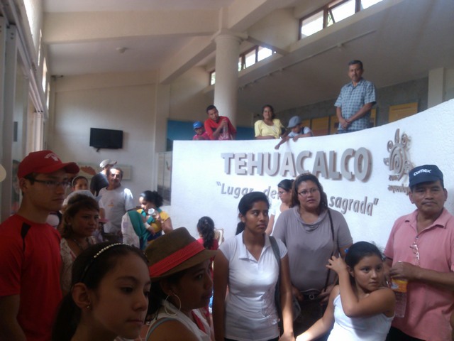
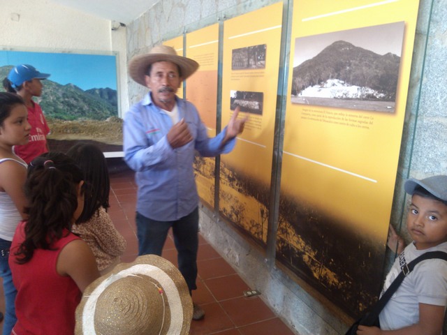
I just returned from El Ocotito, where I spent 6 very laid back days with the family of mi amiga, Lilibeth.

Elizabet,Tomi,Rodrigo, Lilibeth (Omar not pictured)

Elizabet,Tomi,Rodrigo, Lilibeth (Omar not pictured)

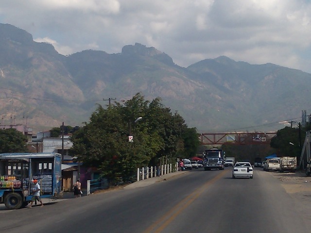
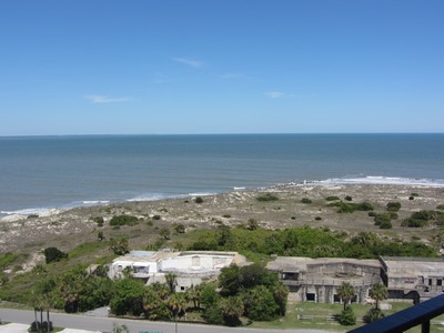
A small town, about an hour from Acapulco via autopista (the equivelant of our Interstate highway) or longer via the carretera federale (the federal highway that goes through all the small towns between here and there), Ocotito is lower in altitude and closer to the coast, so it is hotter, more humid, and much greener than Taxco. The name comes from a kind of tree (el ocotito) which used to cover the hillsides but has pretty much been eradicated in this area now.

Ocotito is a regional town (or center) for many even smaller towns around it and thus has a bustling highway strip business area where people come to buy construction materials, car parts, American clothing, and other things they cannot make or grow themselves. (See Cerro de Indio, Indian Hill in the background?)

Street scene, El Ocotito, Mexico
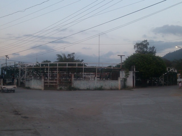
There is even a bull ring in town.

Bull ring, El Ocotito, MexicoIt doesn’t look like much here, but they host some major events several times a year. In July, when they run the bulls in Pamplona, you can be assured, their are bull fights here in Ocotito.

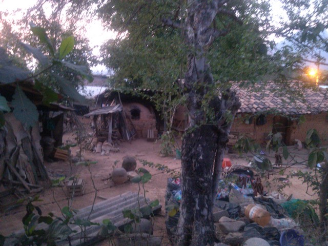
Unlike Taxco where most houses tumble up and down the hillsides, butting up against one another with barely an inch to spare, Ocotito is a typical colonial town where many live in family compounds fenced in by brick, stone, or metal walls.

Even in the center of town, what at first appears to be a really large house, opens its gates to reveal a large courtyard area with a more modest dwelling inside.

The courtyards often contain an outdoor cooking area, a dish washing and laundry area, and out back, separate stalls for toileting and a shower. They may also have a place to park cars, scooters, and bicycles, a work area with a collection of this and that that might be useful someday, perhaps a garden, a few fruit trees, and definitely a collection of dogs, cats, free range chickens (with free range of the entire house), and even a horse or burro or two.

The house might be adjacent or totally above a portion of this area or have a living/sitting area and even an indoor kitchen eating area on the ground floor, especially if they sell something from their home (and most do.) There may also be smaller dwellings along the outside walls that house grown sons and their families — sleeping areas primarily as all other activities are communal. This communal space makes a great place for parties and gatherings, which Mexicans love. Almost anything, like a visitor coming to town, can be an excuse for a party.

Even the most humble abode has at least a porch, perhaps enclosed by a chain link fence, where the family gathers most nights and on weekends. Other compounds, as judged by the ancient adobe walls of their dwellings, have been a rural compound for centuries and remain that way, as the town grew around them.

Old adobe house compound, Ocotito, MexicoHouses are designed for practical use. Sleeping rooms are just for sleeping; there is a bed, a dresser of some kind for folded clothing and a bar in the corner for hanging clothing. A single electric outlet and light bulb in the middle of the ceiling, do not encourage lingering but rather gathering with family in communal areas. (Maybe that is part of why Mexican families are so close.)

Colorful curtains serve as doors or simply a division between children and parents or cooking and sleeping areas. There is no hiding out behind closed doors. Privacy is achieved by asking permission to enter someone’s sleeping/dressing area.

A canvas shelter, broad porch, or the house upstairs provide shelter from the sun and rain, and a place to gather and catch the breeze. Though nights are cool, afternoons get quite hot and indoors, without cross ventilation, can be suffocating. Thus the ever present hammock hanging between the trees.

The people live simply, doing most everything by hand — cooking, cleaning, washing; using resources that are available — tree branches hold up lines of clothes drying in the sun, discarded vinyl posters shade laundry areas, recycled metal roofing covers the cooking area, an old, cracked bathtub catches water for the plants. Akin to America during my grampa’s time (the Depression) — nothing goes to waste.

The yard, outside any garden or fruit tree area is usually bare ground. Instead of mowing the lawn each week, daily they water down the soil by tossing bowls or small buckets full of water over the top, and then rake any fallen leaves or other refuse, which is burned, along with the garbage in a pit out back. This process tends to keep the dust down.

Occasionally you come across a large house, with tall metal fencing, and green grass. When I asked about those places, the answer was always that the people who own them live in the US. Since the dollar is worth quite a bit more than a peso right now, you can build a lot of house with just a small portion of your American earnings. These people, usually employ a couple that live in the house full time and serve as maid and caretaker, as well as a measure of security when they are gone.

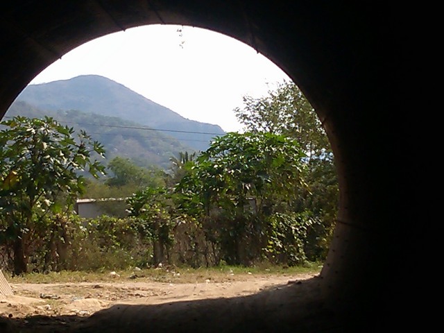
Here are a few more photos from a walk around the neighborhood.

This slideshow requires JavaScript.

Well that is your tour of Ocotito. I hope you enjoyed it.

Coming next: A walk in the country.

Flashback — Mountain High

And now for the rest of the story —

As traBlue Ridge Parkway signvels, even meanders, always do, it came time to turn toward home. Leaving the coast behind, I headed West toward Asheville, North Carolina, the Blue Ridge Parkway and Great Smoky Mountains National Park a place I had lived for a few months just out of high school and other than to drive by occasionally on trips south had not visited again since my early 20s. I spent a couple of glorious days (not nearly enough) driving the parkway which traverses 469 miles through Virginia and North Carolina along the Blue Ridge, a part of the Appalachian Mountains, through tunnels and across streams and deep ravines, all with the glorious backdrop of the blue ridges for miles and miles.

Rising from Asheville at approximately 3000 feet above sea level to 6000+ several times, the climate changed from warm sunshine and blooming dogwoods to still naked trees and brisk wintery winds, then back to the warmth of spring in bloom again. Many scenic overlooks mark your way, along with great hiking opportunities, some easy and some more difficult, to waterfalls and places like Devil’s Courthouse (a cave where the wind makes it sound like someone is talking) and Looking Glass Rock (with a wet face that glows in the sun and shines like a mirror). (L-R below)

My favorite memory is the trip down from Mitchell Mountain, the highest point in the Eastern US. A section of the parkway was closed ahead and I would have had to backtrack at least 30 miles to reach a paved road going down the mountain. Having driven 50-60 miles out of my way, following the tourism office directions to reach the parkway the “easy” way (which I guess means less curves), I was not interested in backtracking that far. Discovering that I did not mind curves (what is with this curvaceous avoidance?), the ranger told me about a forest road shortcut down the side of the mountain that had just been graded, so of course I took it.

What a ride!

The road winds straight down the side of the mountain, switching back and forth and sometimes wrapping around itself, as it follows the terrain and a rushing stream. At the top there is nothing but late winter brown and dull conifers, but as you descend, tiny green leaves soften the stark branches of deciduous trees. Over and over you cross a stream which tumbles over dead fall and boulders — music to your ears. Before long, dogwoods in full bloom delight your eyes as you wind your way into spring warmth. At the bottom, an old mill attests to strength of the water’s flow.

Here are a few scenes from my drive.

This slideshow requires JavaScript.

Asheville is lovely. Like my hometown, Madison, WI (though only 1/4 the size), it is a small city that is big in beauty and culture. Throw in the Blue Ridge Parkway, the Great Smokys around the bend, and Southern charm plus music, artisans, and lots of organic food and you have a city I would love to call home.

In fact, when I came down the mountain to find a camp host in a very off-the-beaten-path federal campground just outside of town, I was very tempted to just stay right there and never leave.


Charleston Chew

I am not a big city bear. I enjoy a day trip to the city, walking amidst the tall buildings, window shopping, people watching, visiting museums and grand big city parks — even riding the subway can be fun. But I hate the chaos of traffic and trying to find a parking spot, especially in a big city that I am unfamiliar with, and even more so when I am the driver, navigator, and sole crash avoider.

Charleston, South Carolina signBeing on the Atlantic coast and reluctant to leave the water behind, I thought I’d take a chance on the city life and make like a Southern belle for a few hours in Charleston, South Carolina. After all, Charleston represents the founding of our nation, Southern charm, and more history than you can imagine.

The plan was to head downtown, take in some history, photograph antebellum homes for the folks back home, have a little dinner in a quaint local establishment in a 200+ year old neighborhood and then head to Asheville and the mountains.

Having avoided Savannah and taken a more direct secondary highway into the state, I missed the official welcome center so I had no state map. Just outside the city I came upon a tourist information center so I stopped to get a map. Being a private tourism office, they make their money from referrals to hotels and restaurants in Charleston; the agent had no state maps and she was not too pleased with my plan to just visit the city for a few hours and hit the road again. (Let’s just say she did not offer a stellar example of Southern hospitality.)

Olde Market, Charleston, South CarolinaThough I asked for directions to the historic area where I could see the antebellum homes and such, she directed me to the Olde Market area — “200 years old and lots of arts and crafts.” OK I am up for that.

Basket vendor, Olde Market, Charleston, South Carolina Niche hotel and horse drawn carriage, Charleston, South CarolinaAfter navigating into the heart of the old city port area, where streets are twisted and narrow, one way and dead ended, driving around for 1/2 hour, dodging people, cars, and horse drawn carriages to find a parking spot, I found the olde market — a succession of 8 – 10 or more brick buildings with open ends and half walls filled with vendors. They have indeed stood here as a place to vend goods (originally from the ships in port and the plantations outside town) for 200 years.

The area was originally a warehouse district, though now the warehouses sport major chain and niche hotels, pubs, and restaurants for the tourists.

Baskets, Charleston, South CarolinaSince I was expecting “arts and crafts,” I was not prepared for the flea market atmosphere — a few handmade basket vendors (a Charleston specialty) and hand sewn bonnets, aprons, and household items, but stalls were mostly filled with 21st century junk “as seen on TV” or you’d find at K-mart. After walking through 3 buildings and literally finding nothing worth even pausing to look at (except the baskets – tourist priced), I bought a handmade lemonade and bolted back to my car. Following my own intuition and with the help of the lemonade vendor, I managed to make my way to White Point Gardens at the water’s edge.

This delightful couple blocks of green space, though under reconstruction in spots, offered a respite from the traffic and chaos. Walking around the area, I discovered the kind of historical homes, large and small, that I was looking for, towering live oaks dripping in Spanish moss, old brick and cobblestone streets, sections of the old city wall, gates offering glimpses of 200 year old courtyards and formal gardens, pavilions, statues, and more historical markers than you could count. Horse drawn carriages were everywhere, telling of the history of certain houses and residents (I guess taking the tour was the “seeing the antebellum houses” the tourism maven had in mind.)

Enjoy this photo tour of the area south of Broad.

This slideshow requires JavaScript.

Fort Sumter, Charleston, South CarolinaBeing a coastal city, a seawall and promenade, 6-feet high and wide enough for 4 people to walk abreast protects the homes from the sea (and served dual duty as a battery in times past (the canons now sit in the park.) From the top, you get a view of Fort Sumter where the Star Spangled Banner was penned. (Never realized this historic fort was so small.)

For some reason, my foot hurt, making it really painful to walk (I learned later I had cracked a metatarsal bone; don’t ask me how) so I departed without finding a local historic establishment for dinner and set my sites on the drive home — via Asheville, North Carolina, and through the Blue Ridge and Great Smoky Mountains.

I have decided that a solo meander is not conducive to big city exploration. Charleston is a charming Southern city, worthy of a couple days or a long weekend of exploration where one can ferret out the historical gems and quaint restaurants. Visit with a friend, spend the money and stay in the heart of the city, and act like a tourist — take the horse drawn tours, visit the market, go to the fort, walk the old streets and live the history of America.

Lighthouses

Take a good look at these lighthouse photos. What do you notice?

Having visited many lighthouses in many locations, I have noticed that each is unique — each a different height, made of different materials, with different paint patterns — but not being a navigator, the real purpose of each light’s unique style and paint job never really crossed my mind.

Tybee Island Lighthouse station signWhen I visited the Tybee Island Light Station and Museum, near Savannah, Georgia, I learned the real and really quite obvious reason for those unique patterns — called a day mark, they are a way to identify which lighthouse is which when you see them by day.

Tybee Island offers a rare opportunity to view a working lighthouse and see how the keeper, his assistants, and their families lived from the late 1700s until the light was automated well into the 20th century.

Climb the 178 steps to the top and think about doing that several times a day to keep the oil lamp burning. Look into the 1st order Fresnel lens (large enough for 4 people to stand inside) which magnifies the light of a single 1000 watt bulb and focuses it into a beam that can be seen 18 miles out to sea.

From the outdoor observation deck at the top, you get a good view of the Fort Screven battery, below, built as a protection for nearby Savannah,as well as the beach, ocean, and nearby coastal cities.

Fort Screven battery from top of Tybee Island lighthouseDon’t leave without lunch at the North Beach Bar and Grill between the lighthouse and the beach. The smells emanating from the kitchen make your mouth water and the coastal Americana decor is a delightful beach break.